Wednesday, September 6, 2017

Forts of Kinsale


After the Spanish sailed into Kinsale in 1601, the British decided they better do something to protect this important harbor, so they not only built one but two forts - one on each side of the mouth of the harbor.  The forts were named, as you might guess, after British kings - Charles Fort and James Fort.

Baxter and I walked around Charles Fort which is on the east side of the harbor.  When we went to James Fort, we decided to take Kala with us to explore.  The design and layout of the forts is interesting and strategic in protecting the harbors and housing the military.  

Both forts were active until 1922 when the Irish voted for independence and the English were booted out of the country.  The lighthouse on Charles Fort has remained active and the fort has opened as a museum.  James Fort is open to walk around the grounds but the inside of the fort is closed to the public.

Kinsale is the harbor in the center where the red triangle is positioned.
Charles Fort is on the right and James Fort is on the left where the chart says '26MT'.  The town of Kinsale is top center of the picture (north side).
In relation to the town, Charles Fort is the orange blob on the bottom right and James Fort is on the left on the peninsula that looks like a thumb
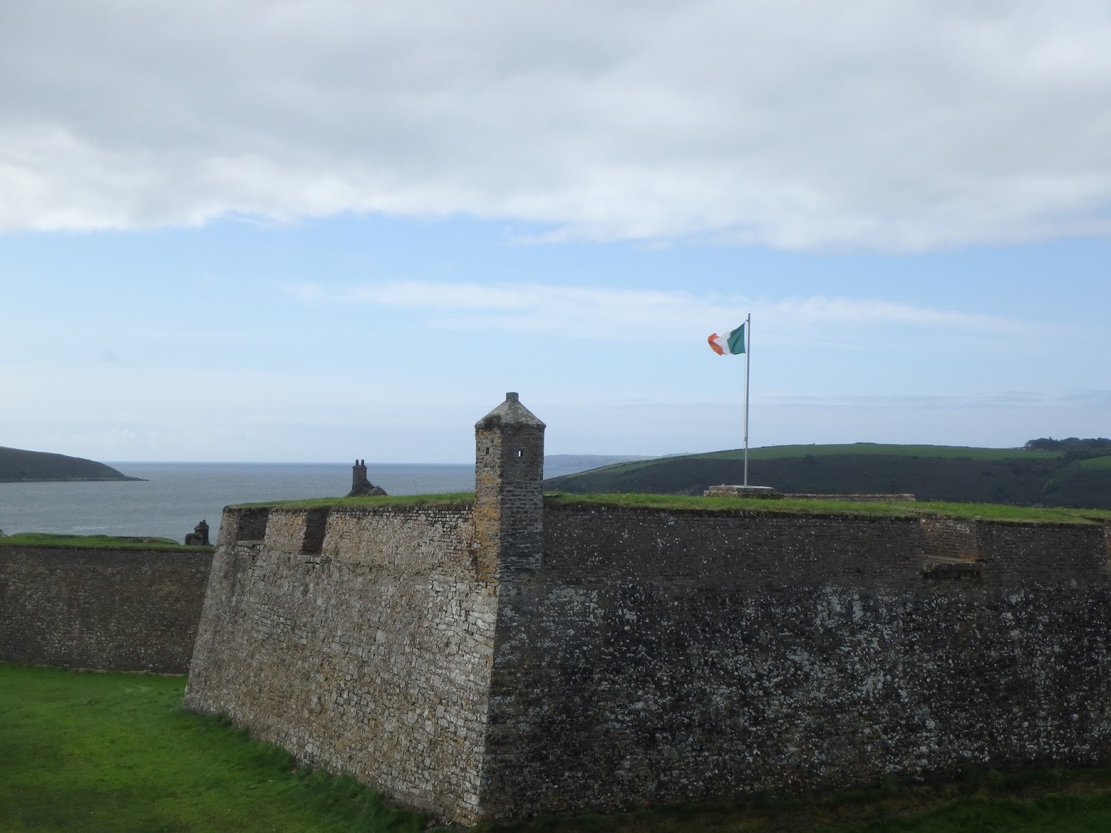
The overview of Charles Fort
Representing Salty Dawg Sailing Association at James Fort
The entrance (closed) to James Fort.  Irish hillside in background
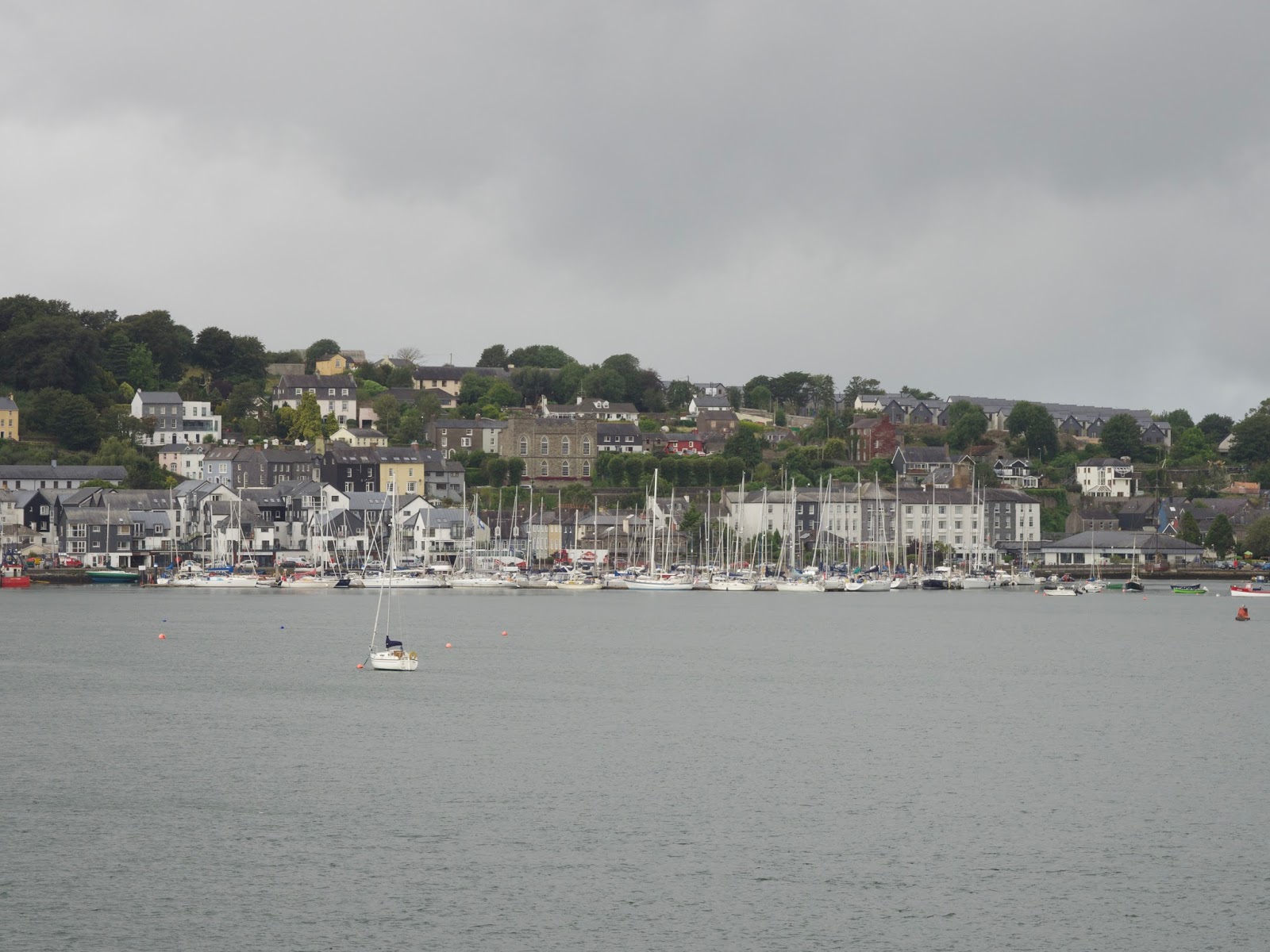
View of Kinsale from James Fort
Kala checking out the views.
The Quarters at Charles Fort - you can see how large this fort is (as it continues in the background) compared to James Fort 
Sailing out of Kinsale Harbor as seen from Charles Fort
The bridge over the mote at Charles Fort
Republic of Ireland - not British anymore
View looking out of Kinsale Harbor from second floor of exhibition hall at Charles Fort
The grounds at Charles Fort
View from the blast wall at Charles Fort, which was just a wall of concrete set next to the magazine to protect the quarters and the rest of the grounds if there was an explosion or if the fort was penetrated by enemies
The stables at Charles Fort 
The lighthouse at Charles Fort
The mechanics of the light
The details of the lighthouse 

Monday, September 4, 2017

Irish History, Impacting the World

As we learned on the Historic Stroll Kinsale, the Battle of Kinsale in 1601 became a pivotal point in history, not just for the people of Ireland but for the Spanish and British, one might dare say the world as well.

It's a long story, as you might guess, so I'll be quick and succinct. In 1601, the Spanish sailed from La Coruna, Spain (just like we did on Terrapin) to Kinsale to sneak up and defeat their arch enemy, England. Irish chieftains (clan leaders) from all over the country (especially in the north) left their lands to fight with the Spanish against the British.  The British were victorious and the defeat was pronounced and complete.  When the Irish farmers went back to their lands, especially in the north, the Scottish (Protestants) had moved in from England, settling the land and bringing their Protestant values.  When Ireland chose its independence from England in 1922, the descendants who were from Scotland decided to align with the British creating a new country called Northern Ireland and breaking from the Republic of Ireland (Roman Catholic).

Oddly enough, it also impacts Brexit today as some might say the pivotal support to leave the EU is from Northern Ireland. Without that demographic in Northern Ireland, the 51% to 48% vote may have turned out to be different.  When the U.K. leaves the European Union in 2019, it will effect the world in so many ways, with issues like trade, monetary values, and tourism to mention the obvious.  It is more apparent to Baxter and I now being here in the midst of it, but it is a point in history that will definitely change the world.

If the Spanish had not sailed into Kinsale that fateful day, Brexit may just be a funny sounding word.
Barry providing a tour of Kinsale with a mural behind him illustrating the changes
The differences are evident.  The door on the left was from prior to the 17th century and then after the city was redeveloped, the door on the right is after the 20th century.
A model of Kinsale with the wall built around it.  Where we were standing would have been underwater.
'World's End Gate' where the Spanish entered through the wall that surrounded Kinsale
A Lima Coin collected by privateers from Spanish ships
The story of the Spaniard in Kinsale

Friday, September 1, 2017

Kinsale, County Cork

We were excited to sail to Kinsale - just a quick 18 miles west of Crosshaven and the south central part of County Cork.  We had heard everyone talk about Kinsale as the "culinary capital of Ireland, possibly Europe" - wow!  They said "just brilliant place to be".  We woke up to heavy fog and a misty rain and motored out of Cobh Harbour (pronounced "Cove").  Our views of the beautiful Irish coastline were sheets of white - with hidden objects scattered around.  We flipped on the radar and watched the miles tick off.  Not really what we had imagined the sail would be like.

As we arrived at Kinsale Yacht Club, we found a very busy town with buses of tourists and parking lots, so different than Crosshaven.  We walked across the street from our slip and registered at the marina and then headed into town, dodging cars and people.  Our lunch was not that great and I was feeling like I wanted to go back to Crosshaven.  The next morning we decided to take a local walking tour, Historic Stroll Kinsale, that talked about the history of the town.  If we were going to stay, maybe they could help us find an affinity for this place.  It worked!!  Barry's stories were so intriguing and gave us a great deal of perspective on how Kinsale was integral to Irish history, British history, Spanish history and even effected Northern Ireland and Brexit.  Now every place we walked, we understood what that exact spot meant to the town and the people.

We decided we would stay in Kinsale for a week.  We spent the time visiting pubs, walking around forts, riding bicycles and planning our upcoming land trip through Ireland.  It turned out to be a fun week and well worth the visit.
The gorgeous view of the Irish coast as we left Cobh Harbour
The view of Charles Fort as we sailed into Kinsale Harbour, it was less than 1/4 mile away
Cool yacht clubs here in Ireland
Nice slip on the face dock (Terrapin second boat on right), but a bit exposed to gales
The Bulman Pub
Kinsale city logo
"...money never made the man nor wealth a happy home"
Wednesday Farmers Market in Kinsale
The path along the river - there is a door just past the lamp post on the right - where do you think that goes?
When you have a big tide, some boats will use the opportunity to clean their bottoms (in this case the blue part of the sailboat tied to the wall) It is a delicate process, but essentially the boat has to be secured to the wall to ensure it doesn't fall over and that it rests on the keel.  Once high tide comes back in, the boat is clean and ready to float off.
County Cork Logo
Sewer cover in County Cork
A pub around every corner - this is The Spaniard
An old castle made into a pub (more about the Spanish on another post)
A LR Defender around every corner
Charles Fort (more on another post)
Small boats, big boats, motor boats, sail boats
Along the new(er) reclaimed property in Kinsale - this used to be 12 feet under water (more later - so much to share).
Not a bad view for a week
The view of Kinsale from James Fort
The old County Courthouse (building with wood shingles on the left) which was also the location of the trial for the Lusitania tragedy and is now a museum.  It was also the market on the water's edge where merchants would bring goods by boat to sell - notice how the streets come from all directions...the right side, where the guy is walking, used to be the water and the left side was a pier.

Monday, August 28, 2017

Crosshaven, County Cork


We arrived in Crosshaven and the images of the bright green Irish hillside from offshore was just what we imagined.  Despite a lack of sleep with Baxter having been on watch since 0330 and my being up since 0500, we popped our heads into the bar at the Royal Cork Yacht Club (the oldest in the world), let them know we had arrived with our dog and then headed to town for food and a pint - does it matter it was only 1030?  Not in Ireland.

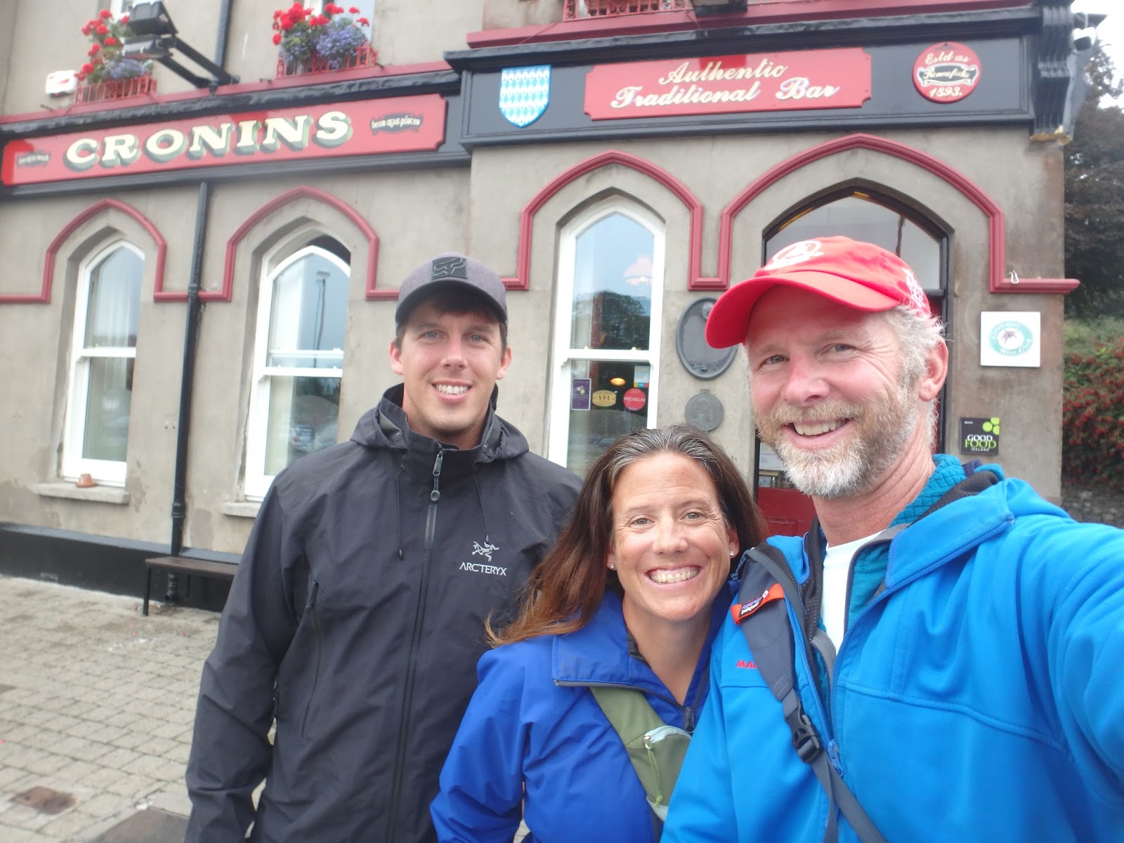
After a short 5-minute walk, passing The Oar Pub and Fitzgibbon's Pub, we found ourselves in Cronin's Pub, a place where we would frequent quite a bit in the coming week.  Cronin's has been in the same family for three generations and the warm welcome and local feel is fantastic.  Most everyone you meet is from Crosshaven or near Crosshaven, and Friday night is standing room only.  We indulged in the Cork-brewed Murphy's stout and Beamis stout, had a lunch of the best fish and chips we had ever had and then waddled back to the yacht club for a nap.  The walk back definitely felt longer than five minutes.

Shortly after returning to the boat, the Department of Agriculture arrived to examine Kala, check her passport and her microchip.  She passed with flying colors and I asked if our visit to Ireland would make things a bit easier when we arrived in the UK with a dog on a private boat.  The vet confirmed - we will see what happens.

We spent the next week enjoying land life.  Kala liked the routine of walking each day, chasing the ball and running down the dock.  It was nice to have an option to eat out or cook on the boat.  It was nice to have storms roll over and be tied to the dock.  But the time had come to move on - Daniel had a friend he was meeting in Scotland and Baxter, Kala and I wanted to check out Kinsale.  So we had a final pint in Crosshaven, Dan caught a bus to Belfast and we sailed west.
Dog park (as in parking lot) at the grocery store.  Any place that makes arrangements for your dog at the grocery store has to be a cool place.
First pint of Murphy's Red at Cronin's
Another pub option
Cronin's quickly became a fave!  By the end of the week, they knew us well.
Walking down the street, the pubs will put their used kegs on the street to be picked up by the beer trucks when they drop off the full kegs.
Tide in Crosshaven is 4 meters (12 feet)...This is what low tide looks like.
Same picture - high(er) tide
When you go to the same place often, you take lots of pictures - especially after a couple pints.
An outdoor party at...wait for it....Cronin's!
Inside Cronin's with the whiskey on tap (on the left)
The Royal National Lifeboat Institution (RNLI) board.  RNLI is manned by volunteers and they are available for rescue 24/7.  'Lighting Up Times' = sunrise / sunset
Liquor on tap - notice the Havana Club rum.  We stocked up in Havana in April.
Daniel had been aboard Terrapin for about two months.  We had a great time together and know that he will have a great time on his adventures in Scotland.

Friday, August 25, 2017

Historic Waters

As we sailed from Nova Scotia to Newfoundland in July, we sailed past the wreck of the Titanic.  The Titanic sank in April 1912 after hitting an iceberg.  Coincidentally, the last port of call for the Titanic was Cork, Ireland….more about that in another post.

Another focal point in history that was relative to our course as we neared Ireland was the wreck of the Lusitania.  The Lusitania was a ship similar to the Titanic and had made many trans atlantic voyages.  The fateful day came in May 1915 just outside Kinsale where it was torpedoed by a German U-boat.  The Lusitania had left New York and was headed to Liverpool with almost 2,000 passengers aboard.  The boat sank in less than 20 minutes and there was only a small percentage of survivors.  The significance was that prior to the Lusitania sinking, the US had taken an isolationist strategy in WWI but with hundreds of Americans aboard a cruise liner (leaving from NY), the Germans had demonstrated an act of war against our country and we had no choice but to become involved.  

The yellow circle is the wreck of the Titanic.  The yellow dotted line is our course up to Newfoundland.  The red arrows are the Labrador and Laurenthian currents as they come down into the Atlantic from the Arctic Sea, bringing icebergs with them.  As you can see, our course was more in line with ice than the Titanic...but we were there in July - they were there in April.

The green circle is the wreck of the Lusitania.  The numbered circles are our course from Spain to Cork (the jog between #5 & #6 is due to oil rigs off shore).  There is a lot of controversy regarding the Lusitania - more about that later.